

.png?width=679&height=526&name=General%20Social%20Posts%20(22).png)
FOND Collaboration
Unified, real-time project view for all stakeholders
FOND Collaboration is a cloud-based platform designed to streamline the management of network project data from planning to permits. Centralize data updates and facilitate cross-functional collaboration, unlocking project productivity and real-time visibility.
Smart, data-driven design collaboration
Display location-accurate network designs, GIS data, and stakeholder feedback in a web-based map. Centralize project data for seamless tracking and a single source of network truth.
Enhanced teamwork and streamlined workflows
Facilitate efficient collaboration with geospatial commenting, customizable visualization, and flexible GIS data imports and exports. Simplify workflows, reduce planning cycles, and improve alignment across teams and stakeholders.
Real-time integration and execution
Leverage real-time field-to-office communication and digital tools to enhance transparency, accelerate timelines, and deliver actionable, cost-effective designs optimized for deployment.
TRUSTED BY


"FOND Collaboration has transformed how we manage and share our designs, making communication seamless and improving efficiency across our projects. Its intuitive interface and real-time data sharing keep everyone aligned, saving us time and reducing errors. It’s an essential tool for our success!"

How are customers realizing value with Collaboration?
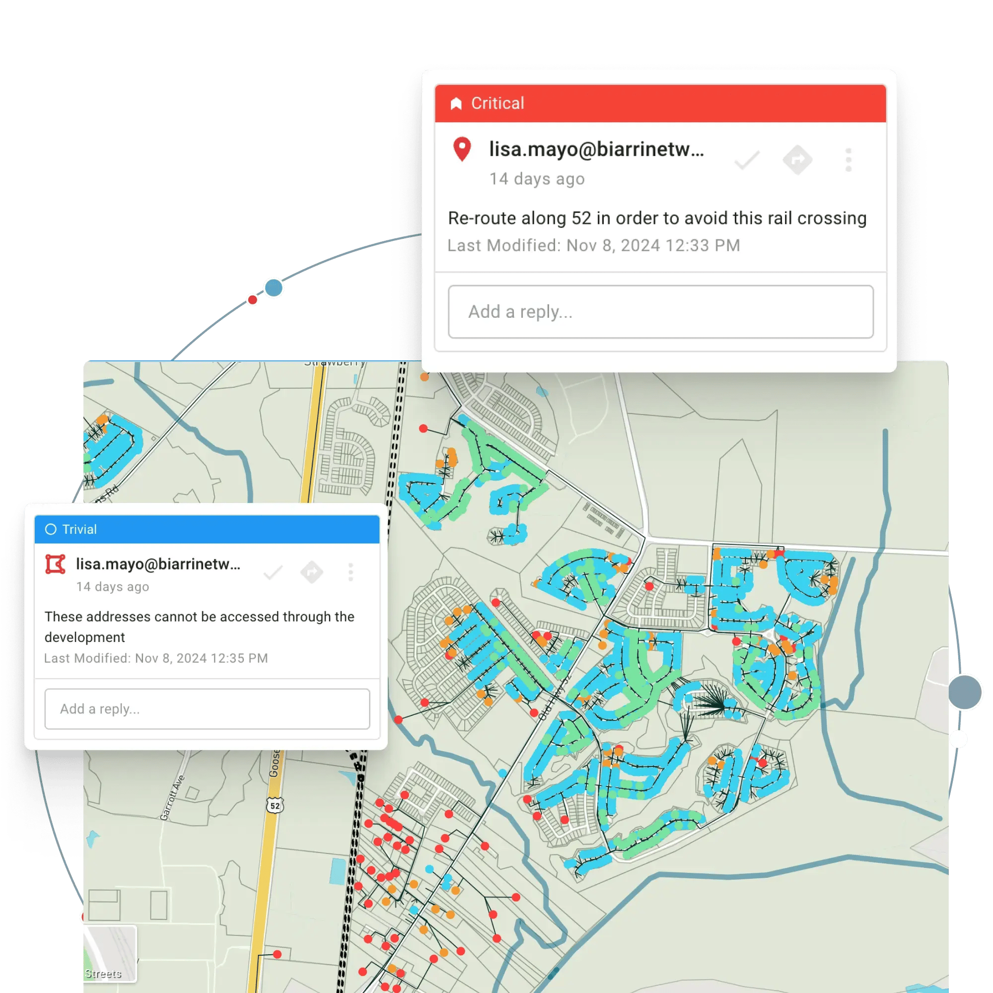
Geospatial Commenting
Users can provide and receive critical feedback directly within the platform, specifying location and severity. This fosters a collaborative approach to GIS, ensuring that issues are addressed promptly.
Style Editor
The style editor allows users to visualize data according to their preferences, promoting consistency and understanding across the team.
Project Versions
Maintaining a history of project versions enables teams to track progress and learn from past iterations, facilitating continuous improvement.
Sharing of Projects
You can easily share a specific project with any team member with just one click. Recipients do not require a paid account in order to view your data.
Data Imports
You may either collaborate on plans generated within FOND, or upload your own GIS data to review on the map. Project attachments can also be used to share non-GIS files with other viewers of the project.
